• Home
  • Download PDF
  • Order CD-ROM
  • Order in Print

Home > Radar Maintenance and Parts Manuals > > Figure 3-9 Radar Line-of-Sight Range Nomograph
Figure 3-8 Methods of Position Plotting
CHAPTER 4. FUNCTIONAL DESCRIPTION

TM-11-5840-360-14-1-1 Radar Set AN/SPS-64(V)5 (NSN 5840-01-034-3946) Manual
Page Navigation
  123    124    125    126    127  128  129    130    131    132    133  
TM 11-5840-360-14-1-1
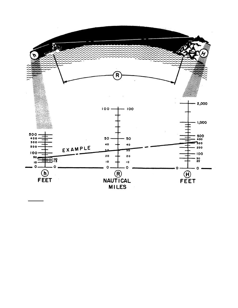
Example: Assume that the antenna is 50 feet above water, and the highest point of land that the vessel
is approaching is 300 feet. In this case, land can normally be observed on the radar display at a range of
approximately 30 nautical miles. A straightedge is set at point h at 50 and point H at 300, and the
expected range R reads 30.
Figure 3-9 Radar Line-of-Sight Range Nomograph
3-24


Western Governors University
< Previous Page
Index ^
Next Page >

Privacy Statement
Press Release
Contact

© Copyright Integrated Publishing, Inc.. All Rights Reserved. Design by Strategico.